
No matter what certain technology providers or consultants might tell you, there is no single approach to wildfire mitigation that works for every electric utility, let alone every field team. Effective mitigation relies entirely on location-specific factors, ranging from local terrain to existing infrastructure to the realities of operational budgets. These factors are driving a necessary shift from reactive fire response to predictive mitigation, a transformation that takes center stage at the Wildfire & Weather Emergency Response Summit taking place August 25th in Chicago, IL, during DTECH Reliability & Resiliency.
During the featured session, “From Risk Maps to Capital Plans: Optimizing Grid Hardening Investments for Wildfire Resilience,” presenters will explore how geospatial modeling and localized asset analytics helped Public Service Company of New Mexico (PNM) execute this shift through targeted protocols that directly enhance system reliability.
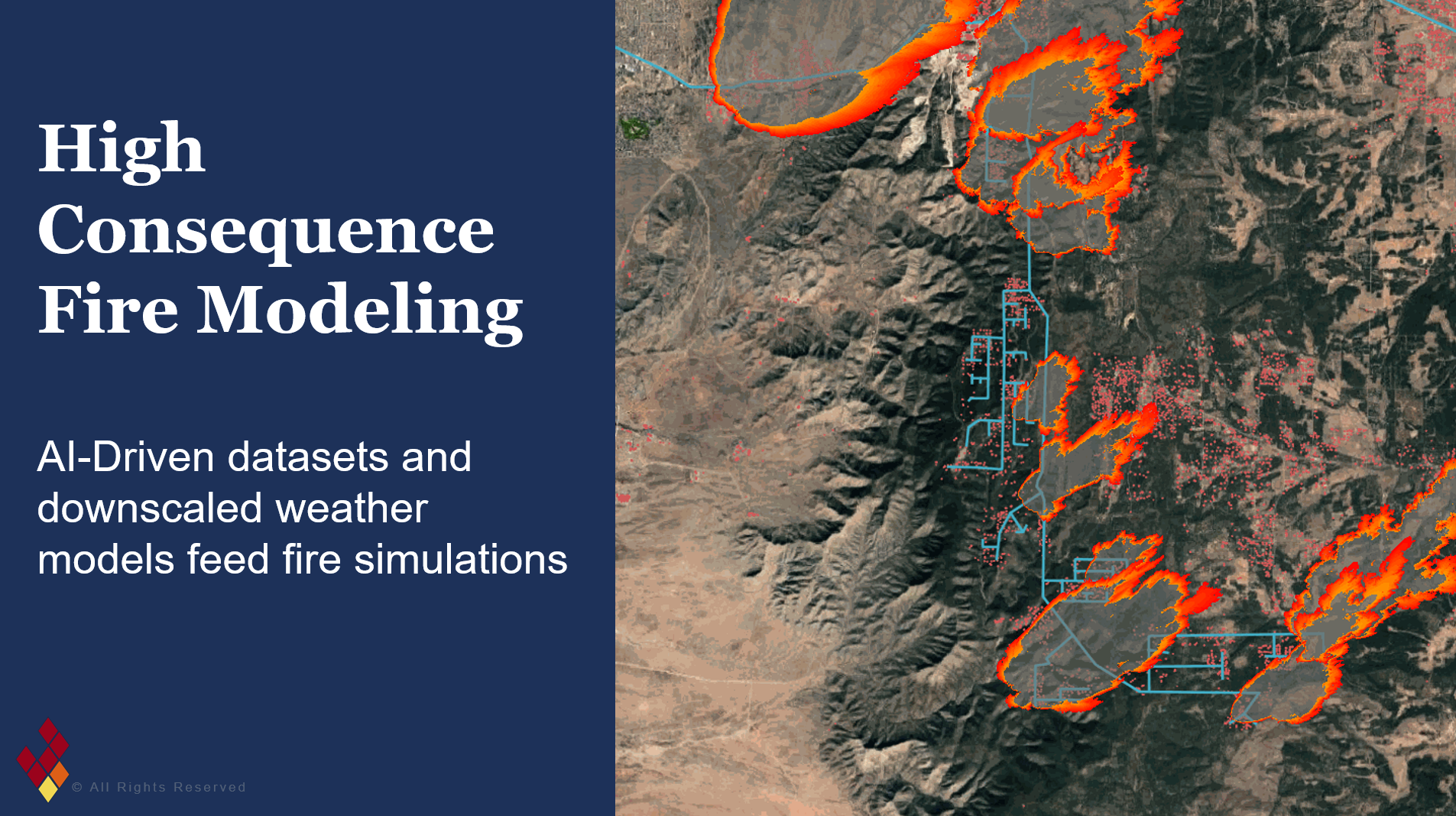
Utilizing advanced platforms like Firescape, utilities such as PNM are adjusting what it means for them to simultaneously evaluate risk and consider reliability. Data that is based on all of those location-specific factors is empowering operators to implement operational safeguards without triggering widespread customer disruptions.

“This technology enables utilities to get really granular about where there is high fire risk and what preventative actions they can take, for both the near-term and long-term planning scale,” said Holly Eagleston from Firescape. “For operations planning, that can mean defining specific times of day that risk peaks, allowing operators to significantly narrow the window where they adjust relay protection settings to mitigate fire, balancing safety with reliability.”
If operators only use the National Weather Service’s Red Flag Warning alerts forhigh-stakes operational decisions, then a mitigation recommendation would be applied to the regional fire weather zone, which can span entire counties. Session attendees will learn how PNM and Firescape replace those sweeping datasets with subcircuit-level visibility to showcase the practical difference this kind of shift makes for field teams and local communities.
“What we’re ultimately trying to do is prevent these ignitions from ever occurring,” Eagleston told Factor This. “It’s about leveraging real-time and forecasted data alongside established operational workflows so teams know how to act quickly. Without these tools, decisions were tied to massive geographic zones. Today, granularity lets operators scale their response down from a county-sized area to a single neighborhood.”
Using this approach, high-resolution data can feed directly into distribution management systems like ADMS via SCADA, giving utilities the ability to automate precise control actions in response to dynamic weather threats moving across their territory.
The value of this approach and these tools extends beyond the field as well, as attendees will see how these granular analytics help teams demonstrate the concrete value of a given grid hardening strategy under tight budget limits for long-term capital expenditure planning. These are the kinds of details that are needed when constructing defensible, regulator-ready business cases.
“Being able to quantify how much risk you have is something that needs to be assessed on multiple levels,” Eagleston said. “How do you define risk? How much risk are you avoiding by each mitigation strategy? We use granular analytics to model every candidate mitigation action, from replacing fuses to installing covered conductor, by the risk it buys down per dollar. Everyone has a slightly different approach to how they’re handling wildfires, and we will be presenting a data-driven approach that everyone can learn from.”
See the full Wildfire & Weather Emergency Response Summit program or register for the event.